

6″ OS map CCXLVII.16 published 1908 Courtesy of the National Library of Scotland
Before 1915 Jagger lane, Kirkheaton; Rawthorpe lane; Dalton Bank road and Nettleton road converged at the crossroads named Four lane ends, Dalton. Rawthorpe lane continued up the hillside to Dalton Hall [Nether Hall and its still existing barn] then towards Moldgreen and Huddersfield by the still existing section of Rawthorpe lane. This was an important major route from Kirkheaton and beyond to Huddersfield dating from the 13th century and possibly earlier.[1]
The section from Four lane ends to Dalton Hall was closed to through traffic about 1915 when construction of the new factory for British Dyes Ltd ( later British dyestuffs corporation) commenced.-shown as a dotted line on the map above. Limited gated access was allowed at the Rawthorpe end for Bankside farm until it was demolished in more recent times. In the 1960’s ICI works police manned the gate at certain times to allow workers access to the site. Later a turnstile was erected.

Rawthorpe Lane in 1994 showing the author. Photographed by the late George Redmonds.
This is one of a number of images which show the lane exactly as it would have been around 1900.
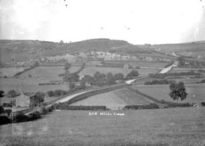
Rawthorpe lane about 1910. K00362 Courtesy Kirklees Image Archive- looking towards Jagger lane and Nab Hill
Lees head Beck-a continuation of Fenay Beck from Waterloo was prone to flooding. The floods of 5th Sept 1931 were the worst in half a century [2]. The Halifax Courier reported that a considerable amount of chemical goods were washed away from the works of the British Dyestuffs corporation.
There were six properties classed as Lees head with a further twelve in the wider Lees valley. Few of the properties can be seen on the 1910 photograph since they are largely hidden by trees. Of particular interest is the Black horse Inn and its bowling green with records from the early 18th century although the property was possibly much older. For further information see the post ” The two Black Horse Inns-Dalton”
John Taylor Jan 2023
Footnotes
[1] Minter, Gordon and Enid; Discovering Old Huddersfield -part three; Barden Print
[2] Yorkshire Post and Leeds Intelligencer 6th Sept 1931

Kirklees Image archive

Rawthorpe Lane
Rawthorpe Lane
Tags for this article:
Recent Archive Posts

Heaton Corn Mill Lepton and Albany house
6 Inch Ordnance survey map OS CCXLV1 SE 1908 -see additional map notes at the end of this article The only watermill for...
Whitley Beaumont- Kirkheaton’s lost stately home
Whitley Beaumont – Kirkheaton’s lost stately home Photo by Smith Carter circa 1910 Courtesy Kirklees image archive k003270 The...

Kirkheaton Jossey Club
The photo above is an enhanced version of the one below donated by the late Jeffrey Hey with names of members shown where known....

Vic Hey-famous Rugby League player with Kirkheaton Roots
Recently, I came across a postcard (above) in our late fathers’ (Jeffrey Hey) photo album which was confusing, as it was...

The Kirkheaton caravan built from a wartime glider
With the end of the Second World War the British government found itself with a surplus of military equipment. Whilst much of it...

Kirkheaton Flood 1935
Kirkheaton Roundabout 2024 Picture by Author A violent storm swept through the West Riding on Easter Tuesday 1935...

Broadhead & Graves mill fire 1964
All design records lost in mill blaze Patterns and design records going back to the firms earliest days were lost in a...

Frank Broadhead
Broadhead and Graves woollen mill This Kirkheaton business on shop lane was a very well known manufacturer of fine...

Lost Colne Bridge
Courtesy Kirklees Image Archive The photograph above shows Colne Bridge in Kirkheaton around 1910 yet none of the buildings in...
Thomas Broadbent’s D-Day Submarine X-20
Thomas Broadbent’s D-Day Submarine X-20 The Broadbent engineering family has a long connection with Kirkheaton dating back to...

D-Day Glider Pilot Sergeant Eric Lightowler
One name that seems to be missing from our local war memorials is that of Eric Lightowler, who was killed in action on D-Day 6th...
Pinion well-the holy well on Liley lane
Until recently a well could be seen just off Liley Lane called Pinion Well. Up to the time of the First World War it was...